
Geodesign Approaches to Land Use + Watershed Planning for the Nose Creek Watershed
Client The City of Calgary
Location Calgary | Alberta | Canada
Watershed planning has been identified as a critical concern for land-use planning in Alberta. In The City of Calgary, ongoing urban development is affecting watershed dynamics by altering riparian and wetland ecosystems, changing water flow regimes due to land use change, and degrading water quality parameters. These trends pose risks of cumulative impacts on downstream receiving environments and water users. To address these challenges, O2 conducted a policy and planning analysis for integrating urban stormwater management with municipal planning and urban development on behalf of The City of Calgary in 2008.
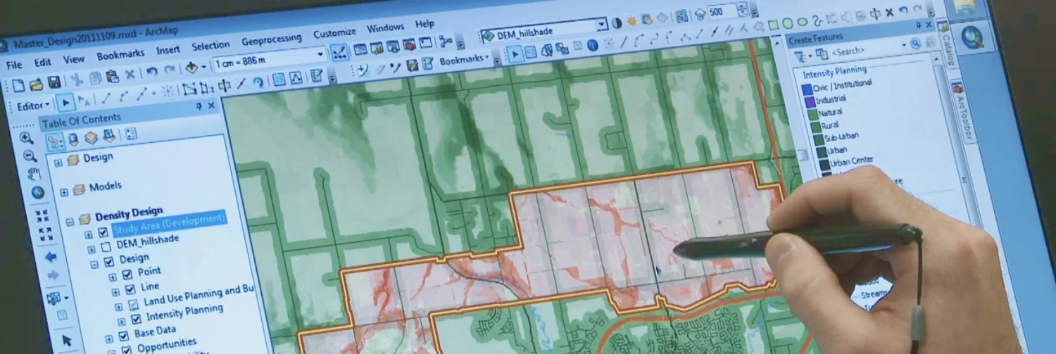
In 2011 and 2012, O2 revisited this project using newly developed GeoDesign technology to test the impacts of conceptual greenfield development scenarios on water balance. O2 integrated a comprehensive set of landscape constraint evaluation models and urban development impact models in a singular design, evaluation, and reporting workflow based in ESRI’s ArcMap GIS and CityEngine 3D modeling software. This technological integration allowed the project team to iteratively explore neighbourhood design scenarios in 2D and 3D, directly informed by automated modeling of impacts on constraints and reporting of each iteration’s impact on water balance in the Nose Creek watershed. The project received an ESRI Canada Award of Excellence for the project, which was presented to O2 at the Calgary ESRI User Conference on May 23, 2012.