
Grande Prairie Environmental Reserve Mapping + Science Based Setbacks
Client City of Grande Prairie
Location Grande Prairie | Alberta | Canada
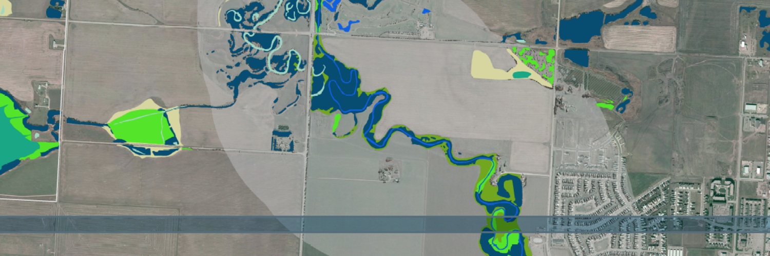
Wetlands, riparian areas and other natural features are a vital component of the ecological infrastructure of cities and regions. Networks of well-connected natural areas provide valuable ecological goods and services, including clean water, flood control, bank stabilization, wildlife and fish habitat, and recreational opportunities. The City of Grande Prairie recognizes the values and benefits of riparian areas, wetlands, and other natural features, and through this project, is making efforts to incorporate, integrate, and restore such areas within an urban context by creating environmental reserves (ERs). Like many communities in Alberta, the City of Grande Prairie has seen rapid growth in recent years. In accordance with the City’s Municipal Development Plan, a sustainable growth framework is now being emphasized. Preserving the natural environment is a key component of this plan. Evaluation of wetland and riparian quantity and quality is required to inform priority conservation areas. Setbacks are needed to provide a balance between development needs and environmental protection. To be solid and defensible, the location of these setbacks should be based on established scientific theory and evidence. O2 provided detailed mapping of riparian zones, including Bear Creek, as well as wetlands, and other ecologically sensitive areas within the City and the IDP region.
O2 produced engaging, comprehensive maps, geospatial information and will recommend setback standards that provide a solid foundation to develop guiding plans for land use and sustainability, planning and policy development for Grande Prairie. O2 provided conservation recommendations based on a set of well defined, intuitive, and spatially explicit criteria, including natural patch size, landscape connectivity locally and regionally, and degree of hydrologic functions (e.g., part of riparian corridor, wetlands, floodplains, alluvial soils, etc.). O2 developed automated, scientifically based GIS methods for mapping each of these indicators and overlaying them into an overall average score that provides an indication of environmental significance.